Dapaong
Dapaong (also known as Dapaongo or Dapango) is a city in northern Togo and prefecture seat of Tône in the Savanes Region, of which it is also the capital. It had a population of 58,071 at the 2010 Census. It is situated 638 km north of the capital Lomé, near the border with Burkina Faso. It is a market town and has a small museum.
Dapaong plays a strategic role in the trade of West Africa because it occupies a privileged place for the transit of goods to Burkina Faso, Benin and Niger. The local economy is therefore one of the most important in Togo. The economic center of the city is the market with various shops which sell fabric, millet and sheep. The main sources of income are from craft manufacturing, trade and livestock, and agriculture (including cotton, millet, corn, tomato (dry season or against-season) and jatropha cultivation. Since the 2000s, the tomato cultivation has intensified around Dapaong exporting to Lome a significant amount of its production.
Dapaong plays a strategic role in the trade of West Africa because it occupies a privileged place for the transit of goods to Burkina Faso, Benin and Niger. The local economy is therefore one of the most important in Togo. The economic center of the city is the market with various shops which sell fabric, millet and sheep. The main sources of income are from craft manufacturing, trade and livestock, and agriculture (including cotton, millet, corn, tomato (dry season or against-season) and jatropha cultivation. Since the 2000s, the tomato cultivation has intensified around Dapaong exporting to Lome a significant amount of its production.
Map - Dapaong
Map


Country - Togo
 |
 |
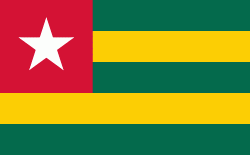
| Flag of Togo | |
Various people groups settled the boundaries of present day Togo between the 11th to 16th centuries. Between the 16th and 18th centuries, the coastal region served primarily as a European slave trading outpost, earning Togo and the surrounding region the name "The Slave Coast". In 1884, Germany declared a region including a protectorate called Togoland. After World War I, rule over Togo was transferred to France. Togo gained its independence from France in 1960. In 1967, Gnassingbé Eyadéma led a successful military coup d'état, after which he became president of an anti-communist, single-party state. In 1993, Eyadéma faced multiparty elections marred by irregularities, and won the presidency three times. At the time of his death, Eyadéma was the "longest-serving leader in modern African history", having been president for 38 years. In 2005, his son Faure Gnassingbé was elected president.
Currency / Language
| ISO | Currency | Symbol | Significant figures |
|---|---|---|---|
| XOF | West African CFA franc | Fr | 0 |
| ISO | Language |
|---|---|
| EE | Ewe language |
| FR | French language |
| HA | Hausa language |